

US Forest Service · Data Source: Recreation.gov
About
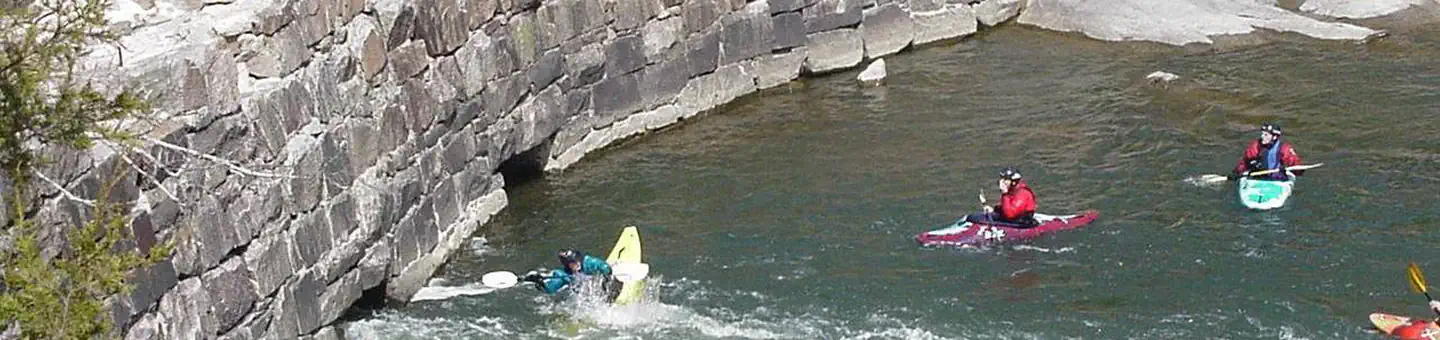
Overview Silver Mines Campground is located on the St. Francis River in the Mark Twain National Forest. It offers a variety of recreational opportunities and abundant historic and geological wonders. Recreation Parts of the river are available for swimming, while other portions provide good fishing. Whitewater kayaking is a popular activity during the springtime when water runs high. Depending on water levels, the state holds an annual kayaking competition the third weekend of March. The 2-mile Silver Mines Trail follows both sides of the river, leading to various picnic areas. A 1.2-mile trail spurs to a popular conservation area, where visitors can view spectacular rock formations along the river. Facilities The campground offers dozens of single-family campsites, as well as large group sites, all available for tent and RV camping. Some sites have 30-amp electric hookups. The large group site can accommodate up to 74 people. Additional sites are offered on a first-come, first-served basis. Picnic tables and campfire rings with grills are provided, as are accessible vault toilets and drinking water. Parking spurs vary from asphalt, to grass, to gravel or dirt. Natural Features This beautiful area is located along the St. Francis River, the only river in Missouri classified as a whitewater river. It is widely used for kayaking during springtime. The campground is located at a historic mining operation and is known for its Precambrian granite and felsite rocks. A variety of wildlife makes its home in the area. Nearby Attractions The Millstream Gardens Conservation Area is located eight miles west of Fredericktown, or four miles west of the campground, on Highway 72. It is home to the scenic Tiemann Shut-ins and other spectacular sights along the riverbed.
Around this stay
Nearest surrounding services and recreation within ~25 mi — not on-site amenities.
- 7.8 mi
fuel station
Fuel station
- 6.5 mi
grocery
Walmart Supercenter
- < 0.1 mi
potable water
Potable water
- < 0.1 mi
trailhead
Riverside (Einstein Mine) Trailhead
- 0.3 mi
attraction
Viewpoint
- 0.1 mi
recreation site
HWY D
No dump station found within ~25 mi. Plan dump access before you arrive.
Contact & access
- MARK TWAIN · MO
Reservations & demand
October weekends are typically reserved about 50 days ahead.
Based on 39 Recreation.gov reservations (Oct 2023–Sep 2024). Historical demand — not live availability.
Outbound provider links only. Roam Atlas does not book sites or show live availability.
Source and verification
Last verified: 10/5/2026
See the Sources tab for provenance detail.